Aerial imagery stories

Aerologix & Soar team up to create massive digital atlas
Mon, 30th Dec 2024
#
smart cities
#
bbc
#
aerial imagery
Aerologix and Soar have teamed up to launch the world's largest digital atlas, integrating over 36,000 drone pilots with 700,000 maps.

Picterra unveils GeoAI platform for plot monitoring
Tue, 19th Nov 2024
#
cleantech
#
sustainability
#
aerial imagery
Picterra has unveiled Picterra Tracer, a GeoAI platform designed to enhance monitoring and compliance for soft commodities and forestry industries.

Nearmap reveals Gen 6 AI with 130 enhanced detections
Mon, 14th Oct 2024
#
smart cities
#
data analytics
#
ai
Nearmap has launched Generation 6 of its AI model, featuring over 130 location-based detections to enhance decision-making across various sectors.

Leaders speak on AI potential & ethical impacts ahead of AI Day
Mon, 15th Jul 2024
#
uc
#
genai
#
data privacy
As AI Appreciation Day nears, industry leaders spotlight AI's transformative impact across sectors, calling for a balance between innovation, transparency, and customer benefit.

Nearmap reveals 'revolutionary' sixth-generation AI model using AWS
Thu, 11th Apr 2024
#
datacentre infrastructure
#
hyperscale
#
public cloud
Nearmap's sixth-gen AI model, developed with AWS, has slashed training time by a striking 98% and increased compute power up to forty times, enhancing precision in aerial imagery mapping.

Tech trio Carbonix, RIEGL & Phase One revolutionise aerial surveying
Tue, 5th Mar 2024
#
uc
#
digital twins
#
agentic ai
Leaders in drone technology, Carbonix, teamed with RIEGL and Phase One, to revolutionise aerial surveying and geospatial data acquisition, paving the way for efficient large-scale 3D terrain mapping.
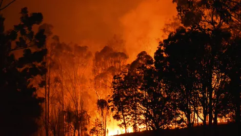
South Australian map technology supporting Kangaroo Island bushfire efforts
Thu, 13th Feb 2020
#
dr
#
cloud services
#
maps
FireFlight's innovative real-time mapping technology aids Australian Army and relief teams in battling Kangaroo Island bushfires, enhancing recovery efforts.
Queenstowners nab Academy Award with aerial motion picture camera technology
Wed, 10th Jan 2018
#
aerial imagery
#
academy awards
#
shotover k1 camera system
Recently the system was used for the movie A Wrinkle in Time with Reese Witherspoon and Oprah Winfrey, and Pork Pie, filmed in Glenorchy.
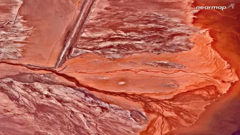
Ten aerial images of Australia like you've never seen it before
Tue, 5th Sep 2017
#
solar power
#
nearmap
#
aerial imagery
Sky-high revelation: Nearmap unveils breathtaking aerial views of Australia ahead of their 10th anniversary celebrations.